Results for "Maps"

World of Maps Project - Preventive Conservation Actions
- Date: February 26, 2019
- Description: Explore our interns’ new techniques for preservation of maps at NMNH: a map transportation tool, a rehousing plan, and training for volunteers.

Smithsonian History/Map Mashup on Historypin
- Date: October 4, 2011
- Creator: Effie Kapsalis
- Description: Access the official records of the Smithsonian Institution and learn about its history, key events, people, and research.
- Blog Post
Mapping the Moon
- Date: May 19, 2009
- Description: Though photographs are accepted as subjective but ultimately faithful visual reproductions of reality, in many instances they don’t correspond to our experience. Pupils don’t regularly glint red, and people don’t transform into the streaked, evanescent smears we so often witness in photos. Yet we have no trouble accepting these inconsistencies, knowing that taking a picture of

Wait, there are bigger map cases? An Intern's Journey in the Oversized Collections
- Date: August 30, 2016
- Description: At the end of Summer 2016, an overview of an intern's work in the archive's oversize collections in the map cases.
Navigating Treatment of the Dawson Map
- Date: May 7, 2019
- Creator: William Bennett
- Description: Our treasures can pose significant—and often unexpected—challenges, like when a map has been attached to a hotel linen. See how our staff tackled a complex intervention in progress!
- Blog Post
Link Love: 10/22/2010
- Date: October 22, 2010
- Creator: Catherine Shteynberg
- Description: [caption id="" align="alignright" width="214" caption="Neighborhood Map (Hopkins, 1887), Hand-colored neighborhood map, Office of the Surveyor Map Collection, Department of Consumer and Regulatory Affairs."][/caption] Looks a lot cooler than it sounds: the Department of Consumer and Regulatory Affairs will post more than a century’s worth of beautiful maps to Flickr [via Effie
Link Love: 10/25/2013
- Date: October 25, 2013
- Creator: Mitch Toda
- Description: Link Love: a weekly blog feature with links to interesting videos and stories regarding archival issues, the Smithsonian, and history.
Link Love: 6/24/2016
- Date: June 24, 2016
- Creator: Effie Kapsalis
- Description: The Stanford David Rumsey Map Collection now has over 69,000 historic maps available online. [via KQED]Incredible color photos of Martin Luther King, some of which are part of our National Museum of African American History and Culture. [via NPR]Great news for geneologists! The Digital Public Library of America & FamilySearch International have signed an agreement that will

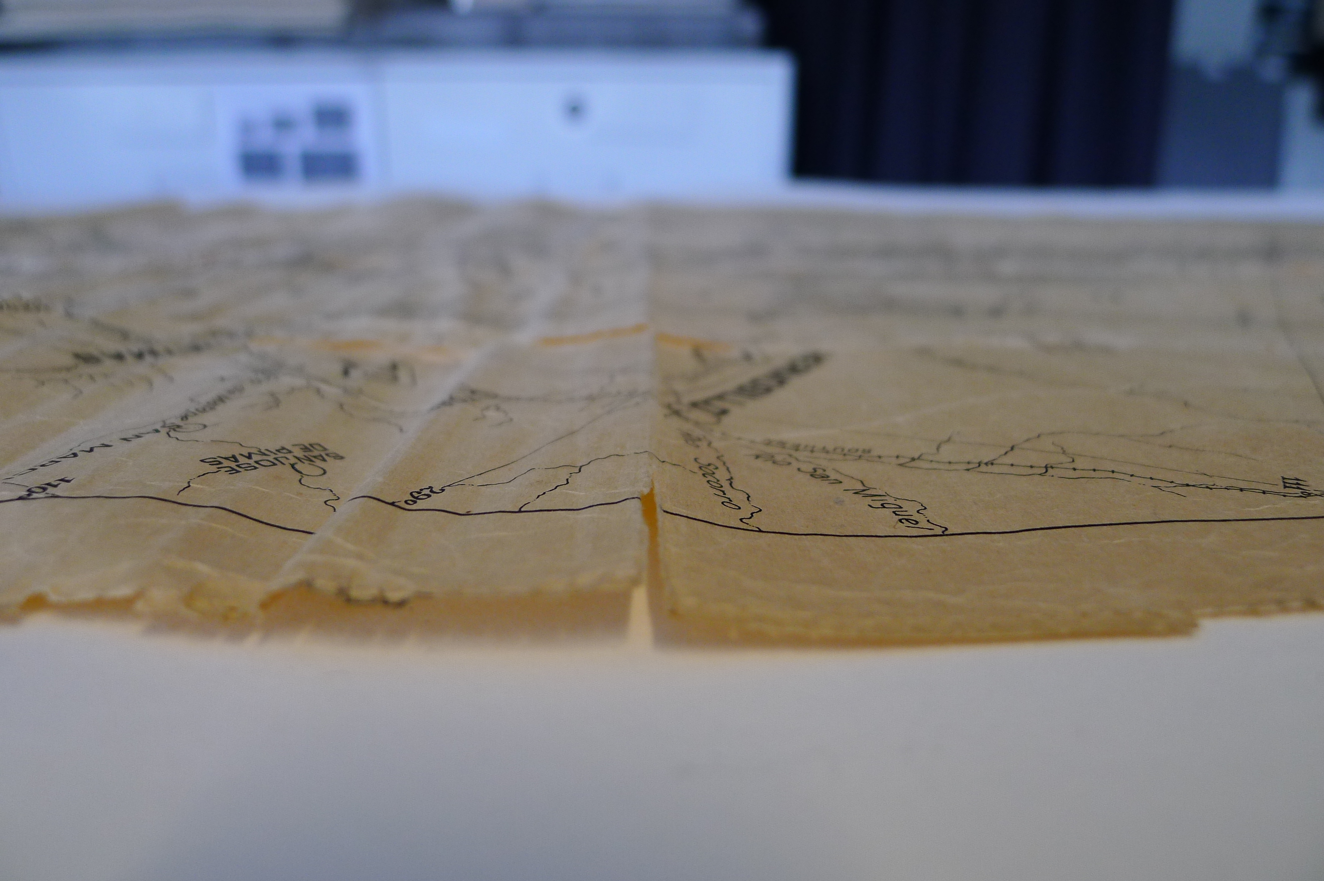
How to Fit a Forest in Five Boxes
- Date: February 11, 2014
- Description: Field maps illuminate the origins of the Smithsonian’s long-term forest-monitoring project.
Link Love: 11/27/15
- Date: November 27, 2015
- Creator: Effie Kapsalis
- Description: Who doesn't love giant treasure-troves of historic photographs? Check out some amazing shots from the history of the Field Museum in Chicago. [via Wired]History detective: Researchers in Amsterdam used Google Maps to pinpoint the exact location of the house depicted in Johannes Vermeer's painting, “The Little Street.” [via Hyperallergic]Want to contribute to public history

Link Love: 8/27/2015
- Date: August 28, 2015
- Creator: Effie Kapsalis
- Description: Photshopping, Victorian-style. [via PetaPixel]A suitable home for an automotive archive; the General Motors historic carriage factory, Durant-Dort Factory One. [via Today's Motor Vehicles]New to the official Oxford Dictionary lexicon; manspreading, MacGyver, and Awesomesauce. [via InfoDocket]A massive treasure-trove of historic maps is now mobile! [via InfoDocket]50 years of

Link Love: 1/8/16
- Date: January 8, 2016
- Creator: Effie Kapsalis
- Description: Aerial images of Washington D.C. from the Boston Public LIbrary. [via Ghosts of DC]Digital maps from University of Richmond's Digital Scholarship Lab and Stamen Design showing social, political, and economic movements in America. [via Smithsonian Magazine]How do you move over 800 space and aviation models? [via Air Space Blog]Perhaps forecasting a new fashion trend, "Design a